safe-landing detection accuracy of the multimodal framework, evaluated on 5,000+ samplesTSU
~91%
aerial images in TSU’s landing-zone dataset archiveTSU
18,000+

The problem

If a cyberattack impairs an air taxi over a city, the aircraft may need to find somewhere safe to land, quickly, using whatever sensing still works. Urban terrain is crowded with buildings, vehicles, and people, and conditions change with light and weather.

Our approach

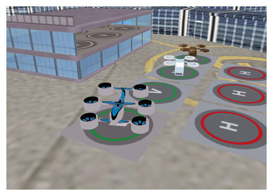
TSU developed IRIS, a physics-based simulation environment with detailed downtown, suburban, vertiport, and airport scenes, eVTOL and drone models, and simulated sensors including RGB and infrared cameras, LiDAR, GPS, and inertial units, under fog, rain, snow, dust, and night conditions.

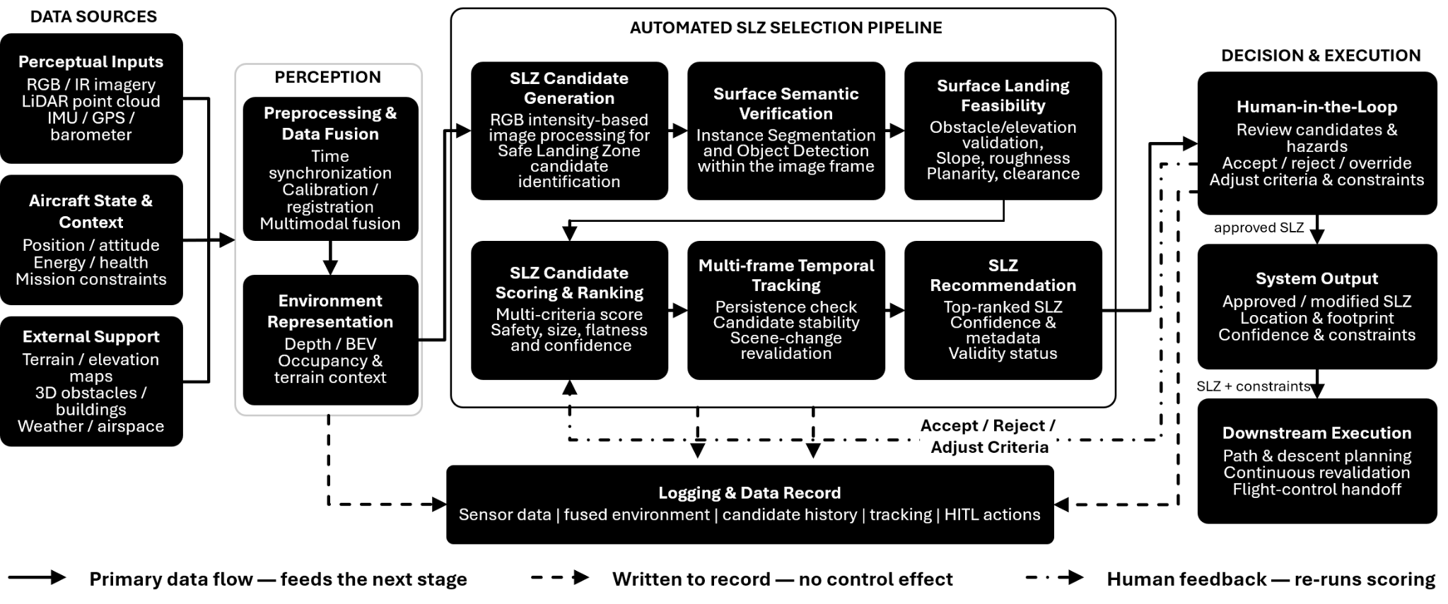
On this foundation, TSU built a multi-hypothesis emergency landing framework:

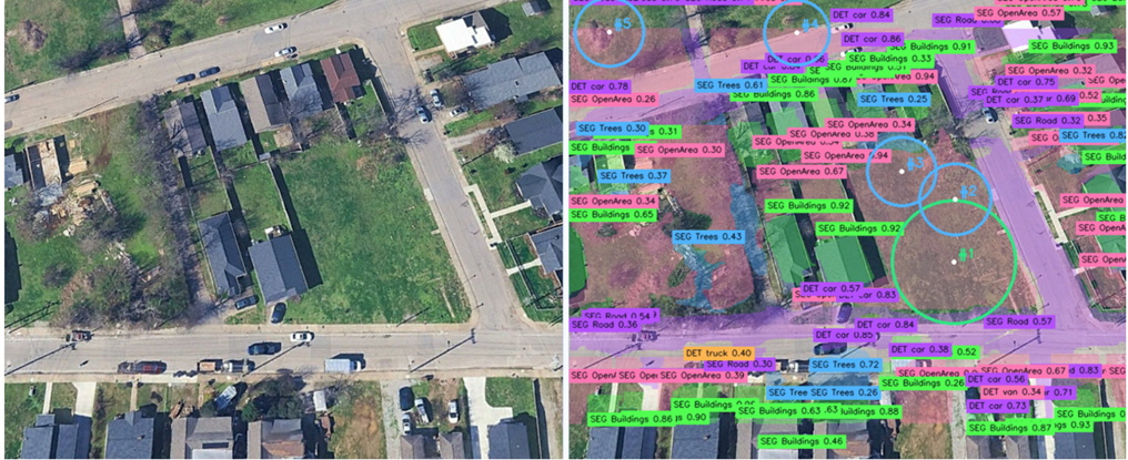
  • Candidate generation from aerial imagery using image processing and learned models.
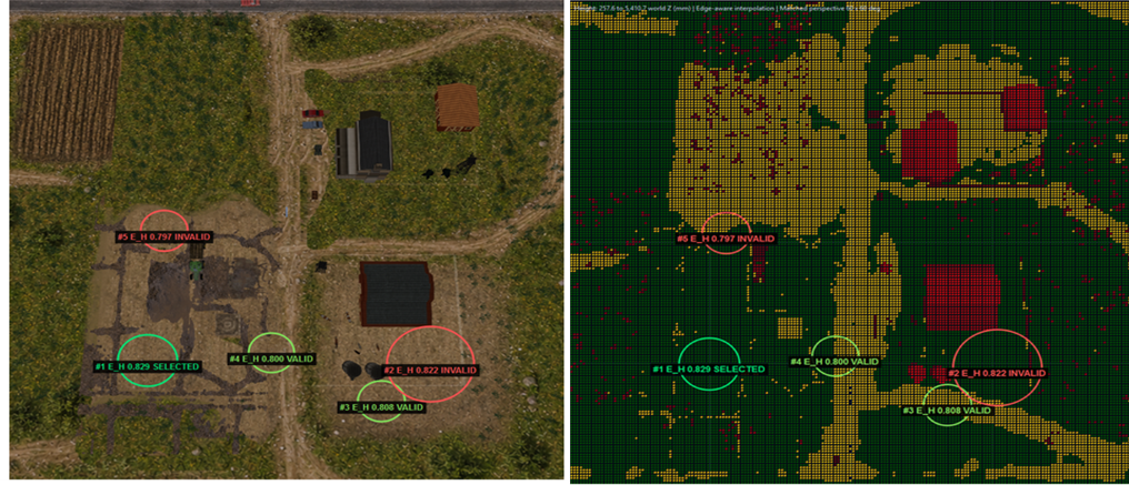
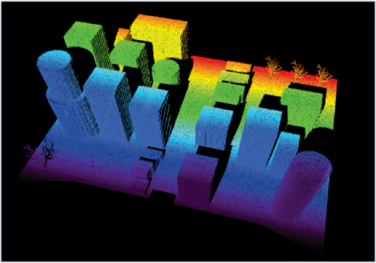
  • Validation with independent evidence: for each candidate, simulated LiDAR checks planarity, slope, roughness, obstacle clearance, and usable footprint.
  • Ranking and tracking: multi-criteria scoring and Kalman-filter tracking keep a stable target during descent, with continuous revalidation and human-in-the-loop review.

The framework was published at SPIE Defense + Security 2026.

Looking ahead

Interfaces to path planning, descent guidance, and flight control prepare the framework for closed-loop demonstration.
Figures

From the research

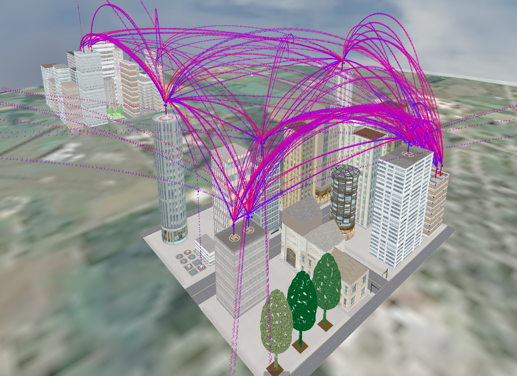
3D city model with many curved magenta flight paths between buildings.
TSUMulti-eVTOL routing between vertiports in a simulated downtown.
Point-cloud rendering of city buildings colored by height.
TSUSimulated LiDAR imagery of a physics-based downtown model.
Rendered rooftop vertiport with an eVTOL aircraft on a landing pad.
TSUA vertiport modeled in TSU’s IRIS physics-based simulation environment.
Block diagram of the emergency landing framework from perceptual inputs through validation to flight-control handoff.
TSUTSU’s multimodal emergency safe-landing-zone framework, from sensing and candidate generation through semantic and geometric validation, tracking, and human-in-the-loop review.
Synthetic aerial view beside a LiDAR-derived occupancy map with ranked landing candidates.
TSUCandidate landing zones checked against simulated LiDAR terrain for slope, roughness, and obstacle clearance.
Aerial neighborhood image beside the same image annotated with detected buildings, roads, trees, and candidate landing circles.
TSUElectro-optical semantic landing-zone selection combining classical image processing with a learned model.